

Geolocation
Stay One Step Ahead with Location-Based Insights
Turn AIS data into actionable insight. Spot risks, track vessel behaviour and stay in control with automated alerts and smart visual layers.
Mainstay Geolocation is the location-based component of our compliance framework, using AIS (Automatic Identification System) data to monitor vessel movements and behaviour.
It automatically detects and flags three key risk areas:
Map layers can be toggled on or off to reveal patterns, events and insights aligned with a vessel’s navigation history and any user-defined parameters, giving you clear, geo-driven context for smarter compliance decisions.
Carbon Intensity Model (CIM)
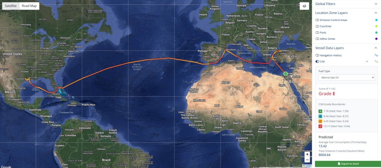
The Carbon Intensity Model (CIM) is MIS Marine’s flexible alternative to the industry-standard CII, offering a more accurate way to assess a vessel’s environmental performance.
It assigns a carbon grade based on actual vessel activity, cargo carried, and distance travelled — with no need for a HVPQ6.
Using a combination of vessel particulars, geospatial activity, and weather/tide data, CIM calculates emissions over a defined timeframe — unlike CII, which only reports annual values.
CIM results can be visualised through the Geolocation layer, helping you monitor environmental performance and model potential voyage outcomes by adjusting criteria like fuel type.
Emission Control Areas
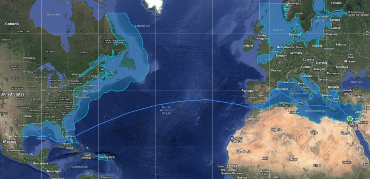
The Emission Control Areas (ECA) layer highlights all current ECAs on the map.
When used alongside a vessel’s Navigation History, it shows exactly where and when a vessel has entered one of these zones.
Vessel Stops
Powered by a growing dataset of over 10,000 berth location zones, our geolocation tools are fully integrated into Mainstay’s analytics and workflows.
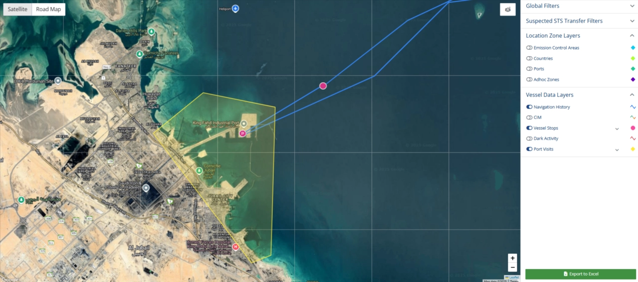
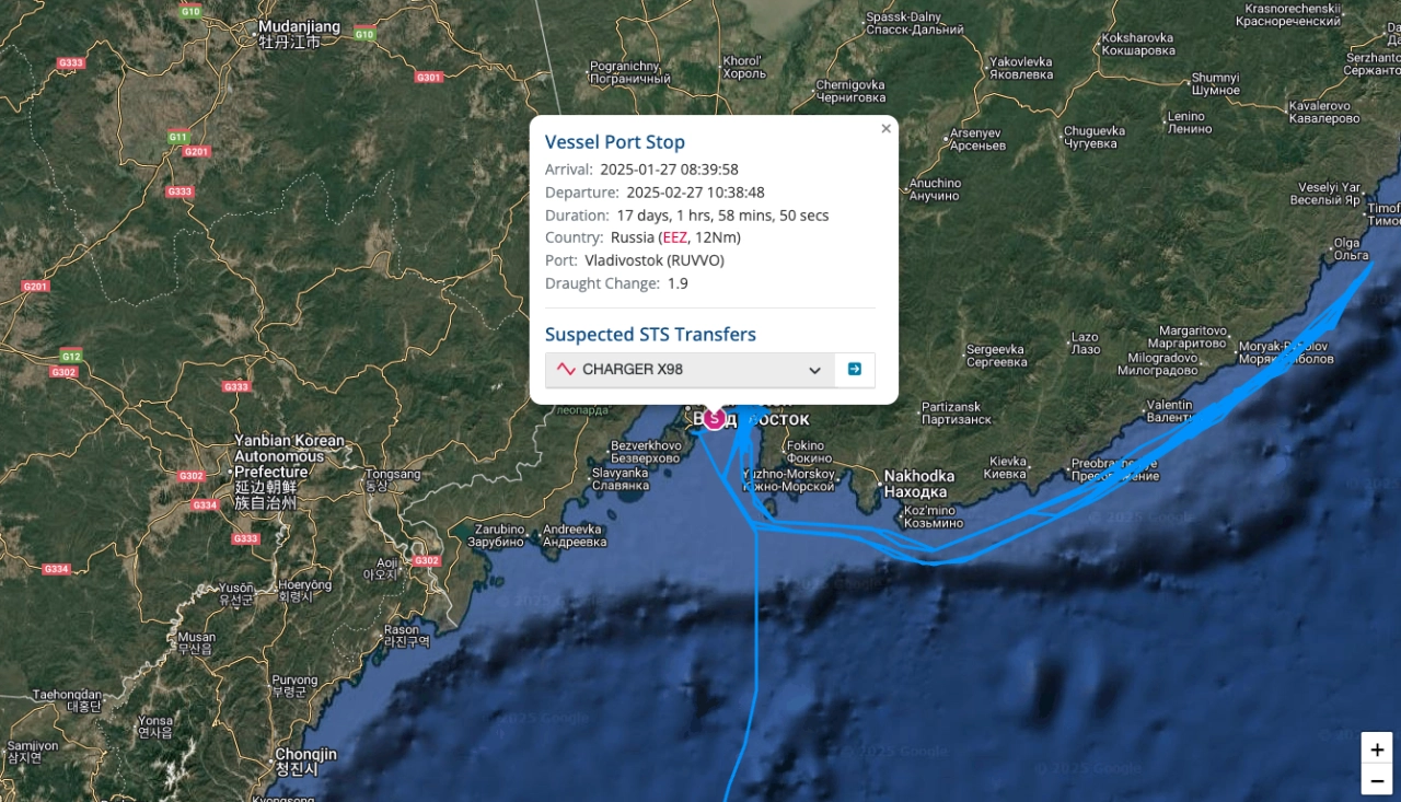
When a vessel remains stationary beyond a set threshold, the system flags a Vessel Stop using AIS data and movement patterns. These are displayed on the map as red markers.
The Vessel Stops layer helps identify port activity, potential STS events, and key operational patterns — all with clarity and precision.
Adhoc Zones
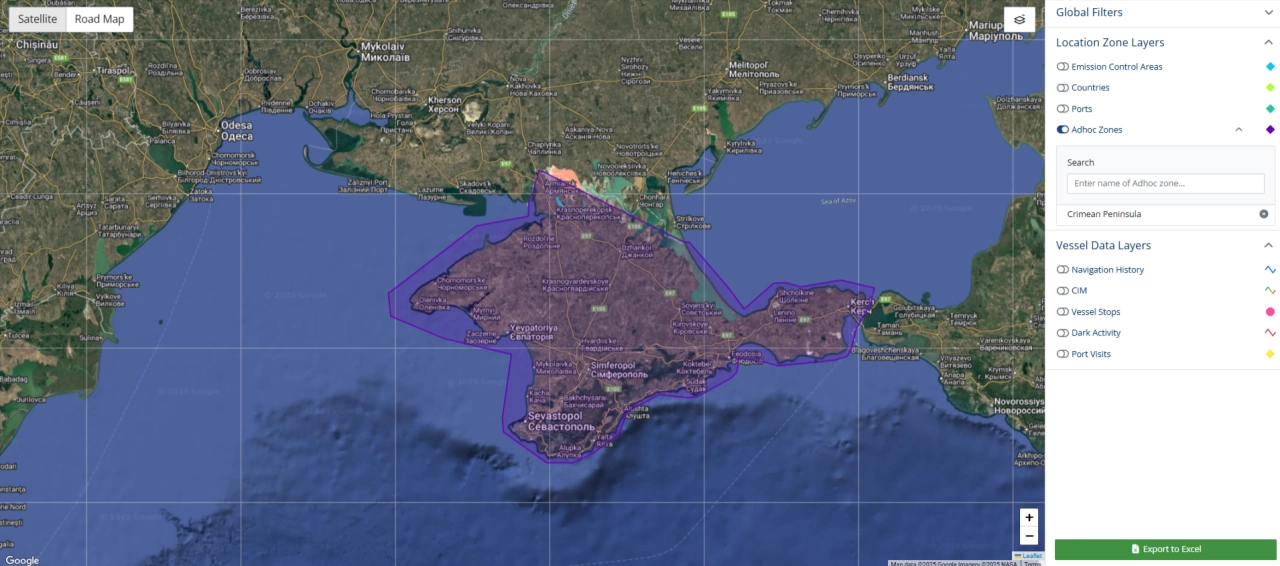
The Adhoc Zones layer highlights custom areas of interest - such as sanctioned or high-risk locations - directly on the map.
Configured to match your organisation’s specific needs, these zones can be updated at any time as your risk profile or priorities change.
Rules can be applied to trigger alerts when a vessel enters a flagged zone, helping you respond quickly to potential compliance or operational risks.
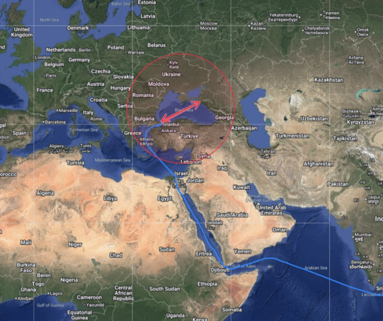
Potential Dark Activity
The Dark Activity layer highlights periods where a vessel’s AIS signal was lost, overlaying this data onto its Navigation History.
It captures key details such as the location of signal loss and recovery, duration of the outage, estimated travel range and any change in draught during that time.
This insight helps identify potential risk events - such as unscheduled stops in sanctioned areas or possible ship-to-ship (STS) transfers while “offline.”
MIS Compliance rules can be configured to flag vessels that have gone dark long enough to raise concern, based on your defined thresholds.
Ship-to-Ship Transfers (STS)
Detect Potential STS Events with Combined Vessel Stop and Dark Activity Layers
By combining vessel stop and dark activity insights, Mainstay STS layer helps assess whether an unauthorised ship-to-ship (STS) transfer may have occurred.
The map displays the vessel’s travel range during the dark period, highlighting any other vessels present in that area during the same timeframe. Built-in rules automatically assess vessel compatibility, such as type and cargo, to identify potential STS matches.
Setting the standard for marine risk management
Complete visibility and seamless flexibility with an integrated system approach
Part of the comprehensive Mainstay assurance platform, Geolocation gives you the visibility to see the full risk landscape.
Designed to work seamlessly with your core vetting and compliance workflows, it brings together vessel movement tracking, dark activity detection and zone-based alerts into a single, coordinated risk strategy.
As an integrated module within Mainstay, it ensures all geolocation insights feed into a unified, end-to-end view of marine risk.
Vetting
Simplify the complexity of vetting across tankers, barges, offshore units and supporting companies with end-to-end voyage assurance across entire journeys, contracts or projects.
Mainstay Vetting
Compliance
Integrate seamlessly with leading global watchlists and data sources, giving you the latest visibility and early warning of sanctions risks.
Mainstay Compliance
Marine Terminal Operations (MTO)
Enhance visibility, efficiency and control through integrated end-to-end terminal scheduling and cargo movement management.
Mainstay MTO
Marine Data Intelligence
Process and aggregate big data to identify global and local trends, forecast potential events, and support smarter, statistically informed operational decisions.
Mainstay Marine BI
Mainstay Geolocation
